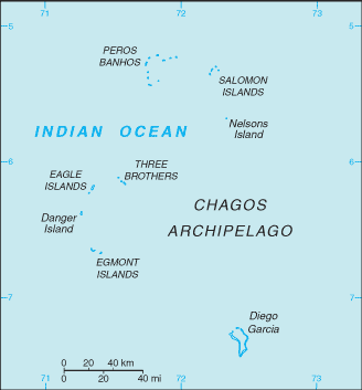
English   Română   Español   Français   Deutsch  

getamap.net

Afrique

Oceanie

Asie

Amerique du Nord

Europe

Amerique du Sud

L'Antarctique


Île Verte


5°19'0" S
71°45'0" E
11:13 (IOT - UTC/GMT+6)

Ile Verte (Île Verte) est un/une île (class T - hypsographiques) en (British Indian Ocean Territory (general)), Territoire Britannique De L'ocean Indien [ Royaume-uni ] (Asia), ayant le code de région Americas/Western Europe.

Les coordonnées géographiques sont 5°19'0" S et 71°45'0" E en DMS (degrés, minutes, secondes) ou -5.31667 et 71.75 (en degrés décimaux). La position UTM est ZV01 et la référence Joint Operation Graphics est SB42-08.

L’heure locale actuelle est 11:13; le lever du soleil est à 08:53 et le coucher du soleil est à 21:00 heure locale (Indian/Chagos UTC/GMT+6). Le fuseau horaire pour Ile Verte est UTC/GMT+6
En 2024 l’heure d’été est valable de - à -.

A île est une parcelle de terrain, plus petit qu'un continent, entourée par l'eau à marée haute.


Country
 Advertisements:


 Advertisements:


Météo Île Verte (Nébulosité, Température, Vent et Précipitation mm probab.)

Sat


Apr 27
Clound 10-10-60-100 Lightning
 
28 °C min
29 °C max
25 km/h
Thu Jan 1

Sun


Apr 28
Clound 20-20-60-100 Lightning
~11 l/m2 94%
 
27 °C min
29 °C max
24 km/h
Thu Jan 1

Mon


Apr 29
Clound 20-40-80-90 Lightning
~19 l/m2 95%
 
25 °C min
29 °C max
23 km/h
Thu Jan 1

Tue


Apr 30
Clound 30-20-50-90 Lightning
~19 l/m2 66%
 
27 °C min
29 °C max
18 km/h
Thu Jan 1

Wed


May 1
Clound 20-10-70-100 Lightning
~5 l/m2 56%
 
28 °C min
29 °C max
19 km/h
Thu Jan 1

Thu


May 2
Clound 40-10-40-90 Lightning
~25 l/m2 63%
 
27 °C min
29 °C max
25 km/h
Thu Jan 1

Météo Graph

Carte et Les photos Ile Verte


Commentaires

--- Il n'y a aucun commentaire ---


Ajouter un commentaire:


Vous devez vous connecter pour ajouter un commentaire!


Login


Register

Mot de passe oublié ?

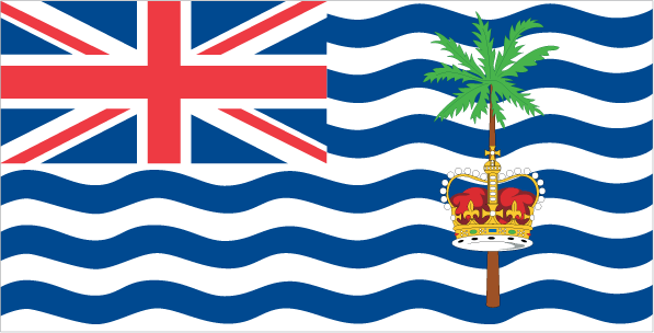
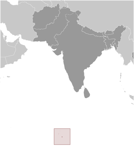
Territoire Britannique De L'ocean Indien [ Royaume-uni ] (Overseas Territory):

Advertisement


Points GPS pres de Île Verte

square Grande Soeur (1 km)

square Ile Manon (2 km)

square Petite Soeur (3 km)

square Ile Pierre (4 km)


square Ile Poule (7 km)


square Ile Diamant (7 km)

square Ile Gabrielle (9 km)

square Danger Shoals (10 km)

square Ile Anglaise (11 km)

square Ile Monpatre (11 km)

square Peros Banhos (11 km)


square Benares Shoals (11 km)

square Ile Parasol (11 km)

square Ile Parasole (11 km)


Points GPS de Territoire Britannique De L'ocean Indien [ Royaume-uni ] (Overseas Territory)

square Egmont British Indian Ocean Territory (general)

square Ile Des Rats British Indian Ocean Territory (general)

square Ile Tattamucca British Indian Ocean Territory (general)

square Ile De La Passe British Indian Ocean Territory (general)

square Camp Cummins British Indian Ocean Territory (general)

square Parry Patch British Indian Ocean Territory (general)

square Petite Ile Coquillage British Indian Ocean Territory (general)

square Ile Jacobin British Indian Ocean Territory (general)


viewweather.com sv.ViewWeather.com
fr.ViewWeather.com
da.ViewWeather.com
de.ViewWeather.com
es.ViewWeather.com
www.carpati.org
www.searchromania.net
Deblocari usi
es.getamap.org
fr.getamap.org
de.getamap.org
nl.getamap.org
da.getamap.org
www.getamap.org
Liens
Conditions d'utilisation
Politique de confidentialité

# 0.0763 sec 

contact AT getamap.net

© 2006 - 2024  https://fr.getamap.net/